heathfold.uk gives each of 33 villages and towns one page, its board, for the things people look up in a hurry, and a set of pages around it for the things they look up at leisure. Every figure comes from a public source and refreshes on its own.
- Villages
- 27
- Towns
- 6
- Rivers
- 8
- Lakes
- 2
- Railway lines
- 3
- Feeds read
- 313
The board
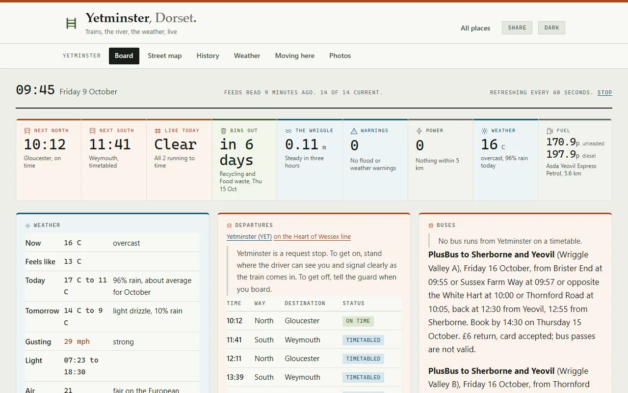
One page per place, in the order people need it. A card only appears where the place has something for it to say.
- Weather and warnings Now, today and tomorrow, the gusts, the daylight and the air quality, and on a sunny day how strong the sun will get. Met Office warnings, and heat and cold health alerts at the top of the board while they're in force.
- Trains Live departures each way, with the platform where there's more than one, tonight's last train, and what to do at a request stop. A place far from any station shows the nearest town's.
- Buses The next buses from the place's own stops. Where no timetabled bus runs, which is most villages, the booked bus that covers it, its next run and when to book by.
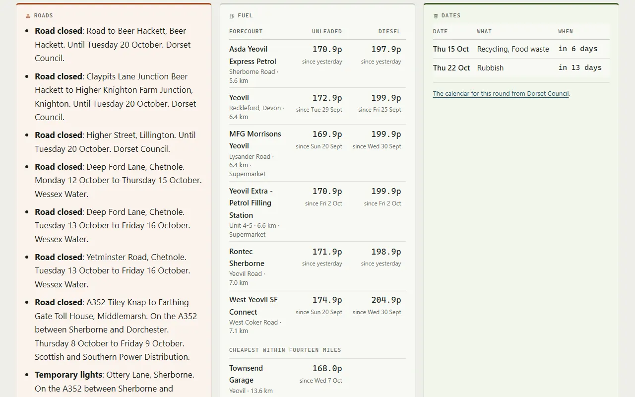
- Roads Roadworks within 3 km and on the main roads out, closures first, each with where, until when and whose works they are, from the government's register of every permit.
- Fuel The nearest forecourts with their unleaded and diesel prices and when each last changed, and on a town's board the cheapest within ten miles.
- Bins The next collection of each kind from the council's own rounds, moved for bank holidays and over Christmas.
- River, rain and groundwater The nearest gauge against its usual range and its records, the rain at the nearest gauges, and the groundwater in the chalk where there is some. A village no river can reach shows its rain instead.
- Storm overflows Whether any overflow within 5 km is spilling now, and the last spills, from the water company's own monitors.
- Floods and power cuts Flood warnings in force nearby, and power cuts from whichever of four electricity networks serves the place.
- Tonight Sunset, when it's dark, the moon, the coldest it will get and the rain before breakfast.
- The parish Where it is, the nearest surgery, schools and tip, and who represents it, from the parish council to the member of parliament.
- Feeds and alerts Every source's state at the foot of the board, and an alerts feed for a feed reader: warnings, health alerts, power cuts and nearby spills, each once, as it happens.
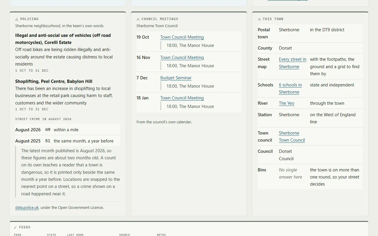
A town's board adds three cards a village doesn't need: food hygiene ratings given in the last 90 days, the police neighbourhood priorities with the month's street crime beside the same month a year before, and the town council's next meetings.
Around each place
Each place has its own menu of pages beside the board.
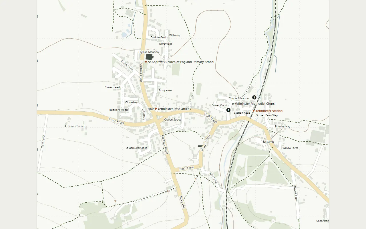
- Street map Drawn for the site, with footpaths, contours and the station. Choose a street or a place from the A to Z under it and the map marks it; every map zooms and drags.
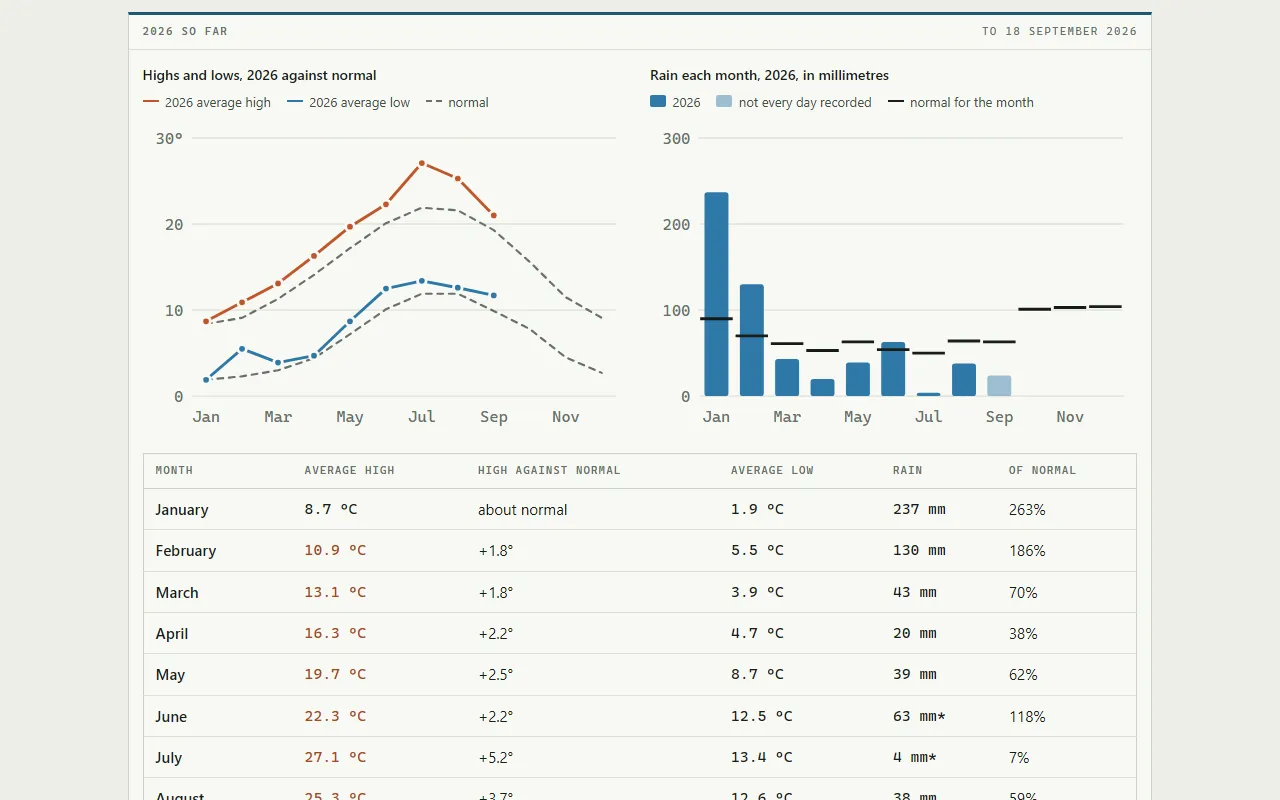
- Weather The records, every year since 1884 in the place's own square kilometre, the last thirty years month by month, and this year against the five before it.
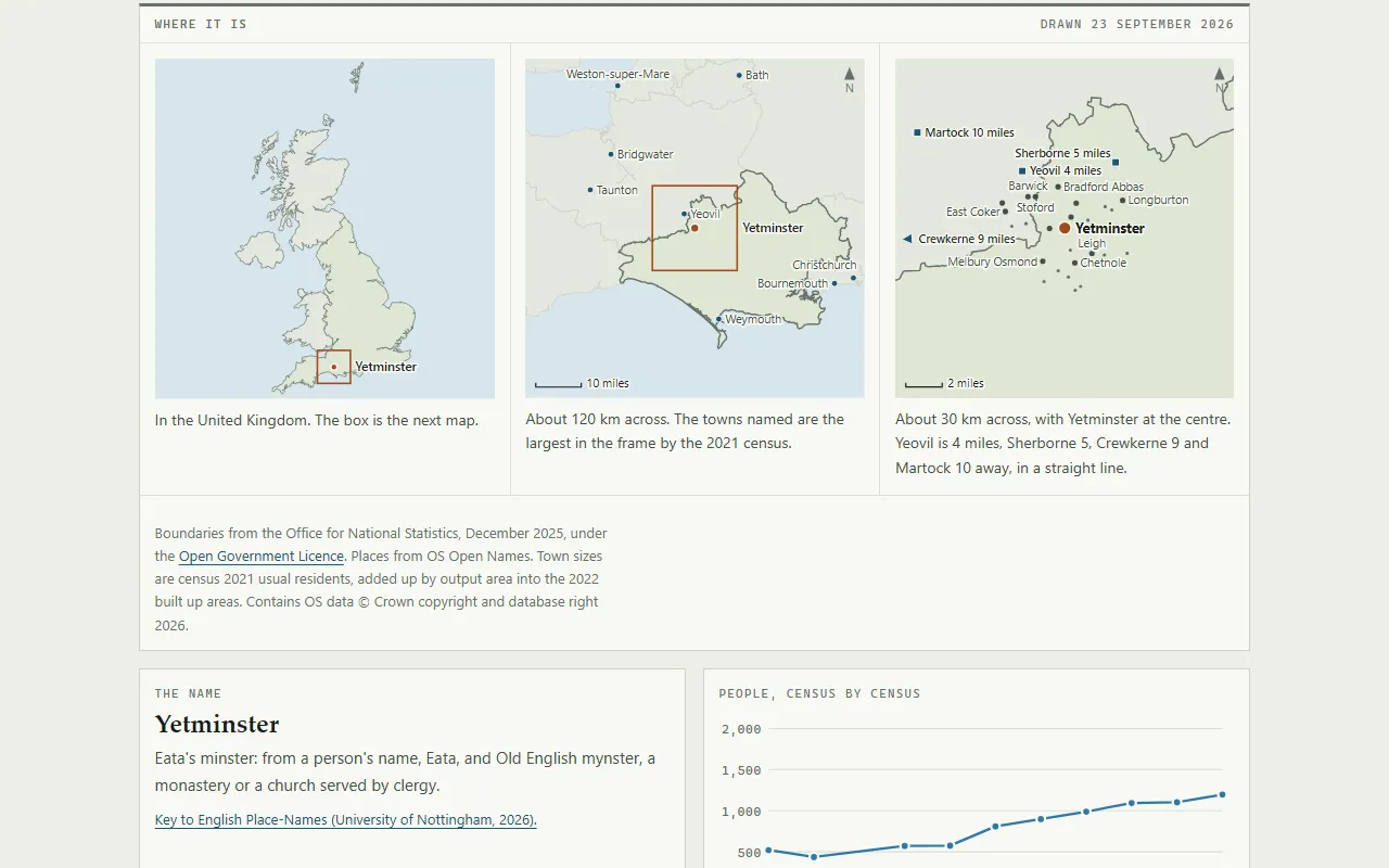
- History Where it is, what the name means, what Domesday Book records there in 1086, and the population census by census.
- Moving here What's in the village: the shops, pubs, halls, schools and churches, each linked to where it is on the map.
- Photos What the place looks like now, by subject, each photograph credited to whoever took it.
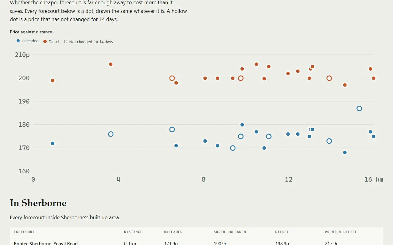
- Schools and fuel For a town, a page for every school, independent schools included, and every forecourt within ten miles with a graph of price against distance.
Across the area
Pages for the things the places share.
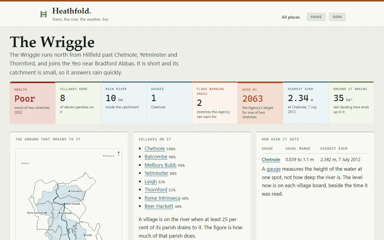
- Rivers A page for each of the eight rivers: its health, the villages on it, its gauge and flood warning areas, its highest level on record, a map of the ground that drains to it, and photographs of the water and its bridges.
- Storm overflows Every overflow on each river, whether it's spilling now and when it last spilled, with its grid reference linked to the water company's map at that spot.
- Lakes Sutton Bingham Reservoir and Sherborne Lake, with the water on a map and how healthy each is said to be, and why.
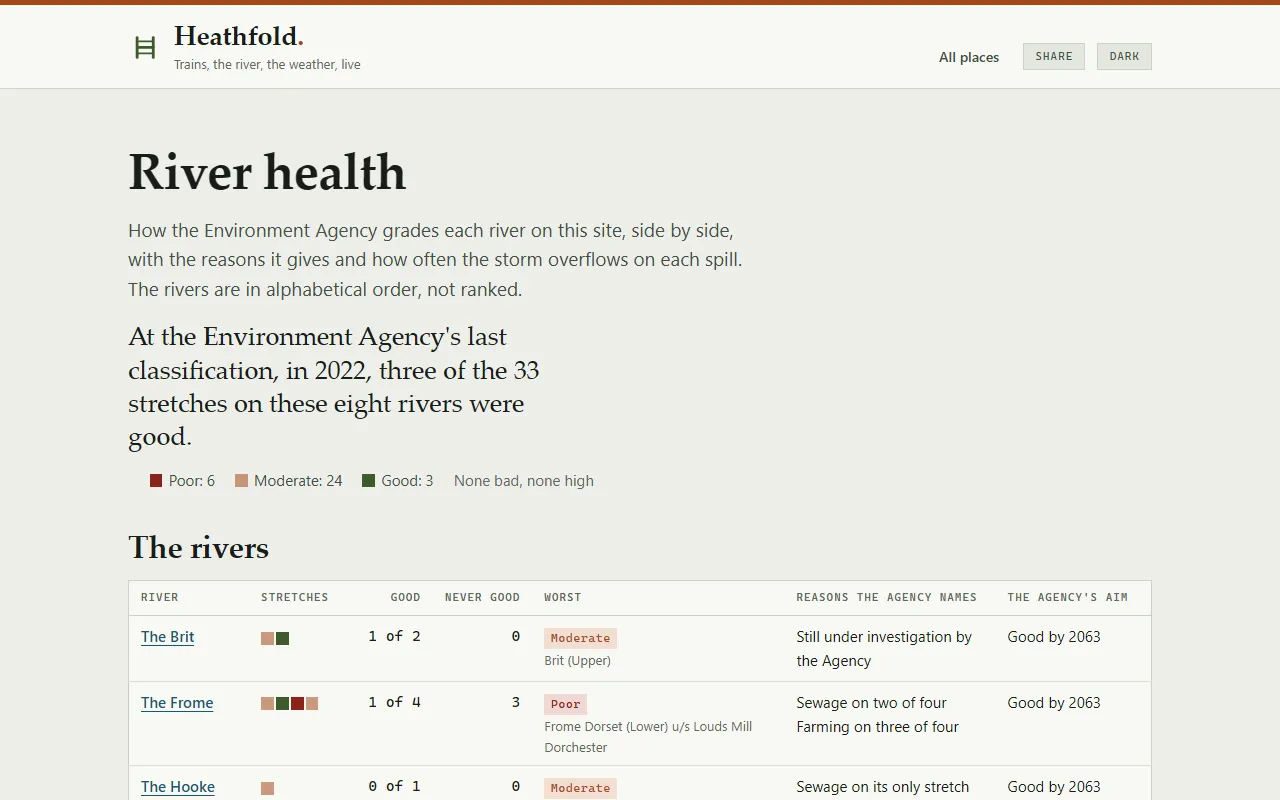
- River health Every river and lake side by side: how the Environment Agency grades each stretch, the reasons it gives, and how often the overflows on each river have spilled every year since 2020.
- Railways A page for each line and each station, so a board can say which way each train is going.
- Counties Dorset and Somerset, and for Dorset an A to Z of every street and place on its village and town maps.
Around the site
- Status One page saying whether every feed is current, and which ones aren't.
- Changes Each numbered release in a line or two of what a reader would notice, and the version at the foot of every page to match it against.
- statusboard.uk A second site asking the question above a village: every weather warning in force in the United Kingdom, every flood warning in England and every power cut the four open networks report, on one page.
- For everybody A share button, a dark setting, no cookies, and an address to write to when something about a village is wrong.
How it's built
The sources it joins, the tests, staging and checks around every change, and what went wrong along the way are on How heathfold.uk is built.